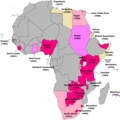
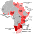
File:British Decolonisation in Africa.png
外觀

預覽大小:600 × 600 像素。 其他解析度:240 × 240 像素 | 480 × 480 像素 | 768 × 768 像素 | 1,024 × 1,024 像素 | 2,000 × 2,000 像素。
原始檔案 (2,000 × 2,000 像素,檔案大小:406 KB,MIME 類型:image/png)
檔案歷史
點選日期/時間以檢視該時間的檔案版本。
| 日期/時間 | 縮圖 | 尺寸 | 使用者 | 備註 | |
|---|---|---|---|---|---|
| 目前 | 2021年11月8日 (一) 08:49 |  | 2,000 × 2,000(406 KB) | Randomastwritter | ogaden |
| 2021年10月30日 (六) 03:23 |  | 2,000 × 2,000(399 KB) | Randomastwritter | juba | |
| 2013年12月7日 (六) 01:38 |  | 2,000 × 2,000(396 KB) | Zello | corrected map that better reflects historical realities (for example South-West Africa, Rhodesia), also Mauritius and Seychelle added, and new colour for territories under temporary military administration after WW2 | |
| 2013年11月22日 (五) 18:52 |  | 757 × 785(159 KB) | Zello | Somalia became a UN Trust Territory under Italian administration in 1949. The correction was requested also on the talk page. | |
| 2009年9月13日 (日) 16:08 |  | 757 × 785(168 KB) | Hejsa | {{Information |Description={{en|Map of British decolonisation in Africa.}} |Source=Transferred from [http://en.wikipedia.org en.wikipedia]; transfer was stated to be made by User:Hejsa. |Date=1 November 2008<br/> ({{Date|2008|11|02}} (original upload |
檔案用途
下列頁面有用到此檔案:
全域檔案使用狀況
以下其他 wiki 使用了這個檔案:
- ar.wikipedia.org 的使用狀況
- ast.wikipedia.org 的使用狀況
- azb.wikipedia.org 的使用狀況
- az.wikipedia.org 的使用狀況
- ba.wikipedia.org 的使用狀況
- cs.wikipedia.org 的使用狀況
- da.wikipedia.org 的使用狀況
- de.wikipedia.org 的使用狀況
- el.wikipedia.org 的使用狀況
- en.wikipedia.org 的使用狀況
- British Empire
- History of the United Kingdom
- Zimbabwe
- Harold Macmillan
- Balkanization
- Decolonization
- Cold War (1953–1962)
- Decolonisation of Africa
- List of national border changes (1914–present)
- Contemporary history
- Portal:Modern history
- User:Jr8825/sandbox 3
- User:Guettarda/Sandbox 50
- User:Falcaorib/Africa
- eu.wikipedia.org 的使用狀況
- fr.wikipedia.org 的使用狀況
- fr.wikiversity.org 的使用狀況
- hy.wikipedia.org 的使用狀況
- id.wikipedia.org 的使用狀況
- it.wikipedia.org 的使用狀況
- ka.wikipedia.org 的使用狀況
- ko.wikipedia.org 的使用狀況
- lv.wikipedia.org 的使用狀況
- mk.wikipedia.org 的使用狀況
- ms.wikipedia.org 的使用狀況
- nl.wikipedia.org 的使用狀況
- no.wikipedia.org 的使用狀況
- pl.wikipedia.org 的使用狀況
- pt.wikipedia.org 的使用狀況
檢視此檔案的更多全域使用狀況。


