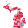
File:2016 United States presidential election results map by county.svg
外观

此SVG文件的PNG预览的大小:542 × 334像素。 其他分辨率:320 × 197像素 | 640 × 394像素 | 1,024 × 631像素 | 1,280 × 789像素 | 2,560 × 1,578像素。
原始文件 (SVG文件,尺寸为542 × 334像素,文件大小:13.32 MB)
文件历史
点击某个日期/时间查看对应时刻的文件。
| 日期/时间 | 缩略图 | 大小 | 用户 | 备注 | |
|---|---|---|---|---|---|
| 当前 | 2025年1月5日 (日) 03:11 |  | 542 × 334(13.32 MB) | Gordfather69 | update |
| 2025年1月5日 (日) 03:02 |  | 542 × 334(13.32 MB) | Gordfather69 | Fixes | |
| 2024年12月13日 (五) 08:07 |  | 542 × 334(13.32 MB) | Gordfather69 | Fix | |
| 2024年11月30日 (六) 04:45 |  | 542 × 334(13.32 MB) | Gordfather69 | Fix | |
| 2024年11月27日 (三) 19:26 |  | 542 × 334(13.32 MB) | Gordfather69 | Update | |
| 2023年3月3日 (五) 23:04 |  | 555 × 352(1.74 MB) | Gordfather69 | line width | |
| 2019年12月1日 (日) 05:37 |  | 555 × 352(1.73 MB) | SpeedMcCool | Fixed Tazewell County, Illinois | |
| 2019年11月21日 (四) 16:06 |  | 555 × 352(1.73 MB) | SpeedMcCool | Updated McCone County Montana | |
| 2019年10月11日 (五) 01:13 |  | 555 × 352(1.73 MB) | SpeedMcCool | Fixed Potter and Lehigh Counties PA | |
| 2018年10月27日 (六) 21:50 |  | 555 × 352(1.73 MB) | Vartemp | Fixed shading for McDonald County, MO. |
文件用途
以下页面使用本文件:
全域文件用途
以下其他wiki使用此文件:
- ar.wikipedia.org上的用途
- bg.wikipedia.org上的用途
- ca.wikipedia.org上的用途
- cs.wikipedia.org上的用途
- de.wikipedia.org上的用途
- en.wikipedia.org上的用途
- fa.wikipedia.org上的用途
- fr.wikipedia.org上的用途
- hu.wikipedia.org上的用途
- nl.wikipedia.org上的用途
- no.wikipedia.org上的用途
- pa.wikipedia.org上的用途


