魯賓遜克魯索島
外观
| 魯賓遜克魯索島 | |
|---|---|
Isla Robinson Crusoe | |
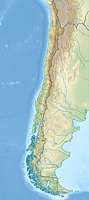
 Map of Robinson Crusoe Island | |
| 自然地理 | |
| 坐标 | 33°38′29″S 78°50′28″W / 33.64139°S 78.84111°W |
| 类型 | Shield Volcanoes (last eruption in 1835) |
| 群岛 | 胡安·費爾南德斯群島 |
| 周围水域 | 太平洋 |
| 面積 | 47.94平方公里(18.51平方英里)[1] |
| 最高海拔 | 915米(3002英尺)[1] |
| 最高點 | El Yunque |
| 管轄 | |
| 智利 | |
| 大區 | 瓦爾帕萊索大區 |
| 省份 | 瓦爾帕萊索省 |
| 島群 | 胡安·費爾南德斯群島 |
| 人口统计 | |
| 人口 | 843[2](2012) |
魯賓遜克魯索島(西班牙語:Isla Robinson Crusoe),以前稱為馬斯地岛(西班牙語:Isla Más a Tierra),是智利的島嶼,位於亞歷山大塞爾扣克島以東181公里的太平洋海域,由瓦爾帕萊索大區負責管轄,屬於胡安·費爾南德斯群島的一部分,面積96.4平方公里,最高點海拔高度916米,2011年人口859。
此岛显然因为《鲁宾逊漂流记》得名,乃因该作主人公原型、苏格兰人亞歷山大·塞爾科克在该岛流落四年之久。
參考文獻
[编辑]- ^ 1.0 1.1 Torres Santibáñez, Hernán; Torres Cerda, Marcela. Los parques nacionales de Chile: una guía para el visitante. Editorial Universitaria. 2004: 49 [2019-04-03]. ISBN 978-956-11-1701-3. (原始内容存档于2019-04-03) (Spanish).
- ^ "Censos de poblacion y vivienda" (页面存档备份,存于互联网档案馆). Instituto Nacional de Estadísticas (2012). Retrieved 2 January 2013.
外部連結
[编辑]- Routes around the island with descriptions and photos of sights
- Robinson Crusoe Island satellite map with anchorages and other ocean-related information
- A detailed map of the island, showing footpaths and walkers' refuges is available in this online document
- Juan Fernandez Photo Gallery - images of landscapes, flora and fauna of Robinson Crusoe Island
- Robinson Crusoe, Moai statues and the Rapa Nui: the stories of Chile’s far-off islands (页面存档备份,存于互联网档案馆)
- A digital field trip to Robinson Crusoe Island.
- Chasing Crusoe: A multimedia documentary website about the island
- Apocalypse Island (页面存档备份,存于互联网档案馆) Information about the History Channel program on rock formations on the island.
- Apocalypse Island Debate about a History Channel program on rock formations on the island.
| 这是一篇與智利地理相關的小作品。您可以通过编辑或修订扩充其内容。 |

